Title:
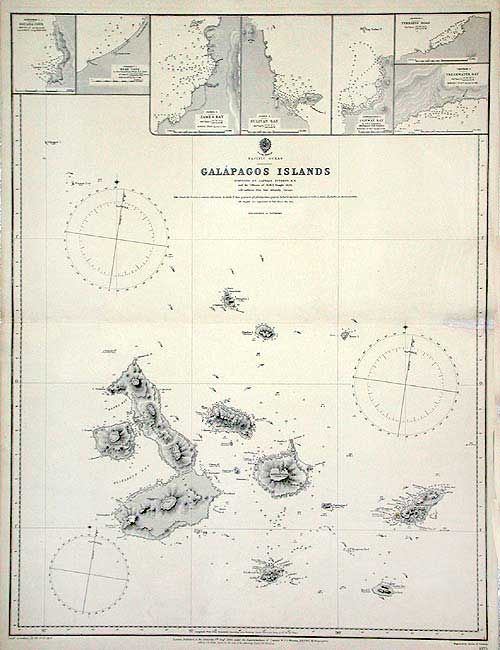
“Pacific Ocean Galapagos Islands Surveyed by Captain Fitzroy, R.N. and the Officers of H.M.S. Beagle”
Map Maker:
British Admiralty
Detailed navigational chart of the island group, w... (full text available to subscribers)
| Item Detail |
| |
| |
MapMaker: |
British Admiralty
|
|
| |
| |
Subject: |
Pacific Ocean - Galapagos |
|
| |
Period/Size: |
1836 / 24.5" x 18.6" (62.3 x 47.3 cm)
|
|
| |
Color: |
Black & White
|
|
| |
Condition: |
(B) Map is fine except for an old repair on centerfold extending 1.5" into blank portion of map. (condition help) |
|
| |
Source: |
|
|
| |
References: |
|
|
| |
|
|
| Sales Information |
| |
| |
Price: |
|
|
| |
| |
Offered by: |
Old World Auctions |
|
| |
Catalog: |
Auction No. 104 - Antique Maps, Charts, Atlases & Globes (351) |
|
| |
Lot/Item #: |
626 |
|
| |
| |
Date: |
09/2003
|
|
| |
| |
|
Antique Maps - Valuation and Pricing, Descriptions, Resources |
|
Home |
Information |
Search |
Register |
Contact Us |
Site Map
Americana Exchange, Inc. © 1999 - 2024 Americana Exchange, Inc.. All rights reserved.
OldMaps.com, the OldMaps.com logo and
AMPR are service marks or registered service marks of Americana Exchange, Inc..
|