Title:
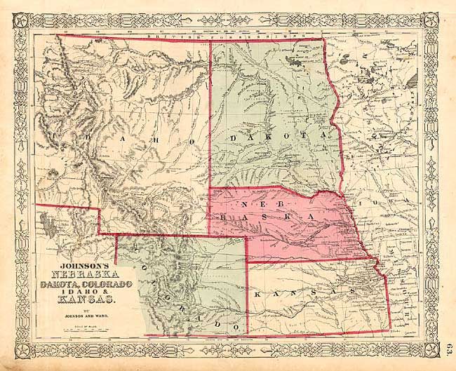
“Johnson's Nebraska, Dakota, Colorado, Idaho & Kansas”
Map Maker:
Johnson & Ward
Depicts Idaho Territory prior to the creation of M... (full text available to subscribers)
| Item Detail |
| |
| |
MapMaker: |
Johnson & Ward
|
|
| |
| |
Subject: |
United States - Central and Rocky Mountain States |
|
| |
Period/Size: |
1865 / 12.7" x 15.7" (32.3 x 39.9 cm)
|
|
| |
Color: |
Colored
|
|
| |
Condition: |
(B) Even toning with good coloring. A few foxing spots and some marginal soiling, else very good. (condition help) |
|
| |
Source: |
|
|
| |
References: |
|
|
| |
|
|
| Sales Information |
| |
| |
Price: |
|
|
| |
| |
Offered by: |
Old World Auctions |
|
| |
Catalog: |
Auction No. 104 - Antique Maps, Charts, Atlases & Globes (351) |
|
| |
Lot/Item #: |
183 |
|
| |
| |
Date: |
09/2003
|
|
| |
| |
|
Antique Maps - Valuation and Pricing, Descriptions, Resources |
|
Home |
Information |
Search |
Register |
Contact Us |
Site Map
Americana Exchange, Inc. © 1999 - 2024 Americana Exchange, Inc.. All rights reserved.
OldMaps.com, the OldMaps.com logo and
AMPR are service marks or registered service marks of Americana Exchange, Inc..
|