Title:
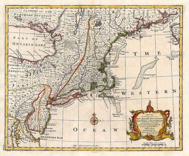
“A New and Accurate Map of New Jersey, Pennsilvania, New York and New England, with the adjacent Countries…”
Map Maker:
Emanuel Bowen
Very nice chart of the northeast from the Chesapea... (full text available to subscribers)
| Item Detail |
| |
| |
MapMaker: |
Emanuel Bowen
|
|
| |
| |
Subject: |
Colonial New England |
|
| |
Period/Size: |
1757 / 13.7" x 17.0" (34.8 x 43.2 cm)
|
|
| |
Color: |
Colored
|
|
| |
Condition: |
(A+) (condition help) |
|
| |
Source: |
A Complete System of Geography |
|
| |
References: |
McCorkle # 744.4. |
|
| |
|
|
| Sales Information |
| |
| |
Price: |
|
|
| |
| |
Offered by: |
Old World Auctions |
|
| |
Catalog: |
Auction No. 104 - Antique Maps, Charts, Atlases & Globes (351) |
|
| |
Lot/Item #: |
133 |
|
| |
| |
Date: |
09/2003
|
|
| |
| |
|
Antique Maps - Valuation and Pricing, Descriptions, Resources |
|
Home |
Information |
Search |
Register |
Contact Us |
Site Map
Americana Exchange, Inc. © 1999 - 2024 Americana Exchange, Inc.. All rights reserved.
OldMaps.com, the OldMaps.com logo and
AMPR are service marks or registered service marks of Americana Exchange, Inc..
|