Title:
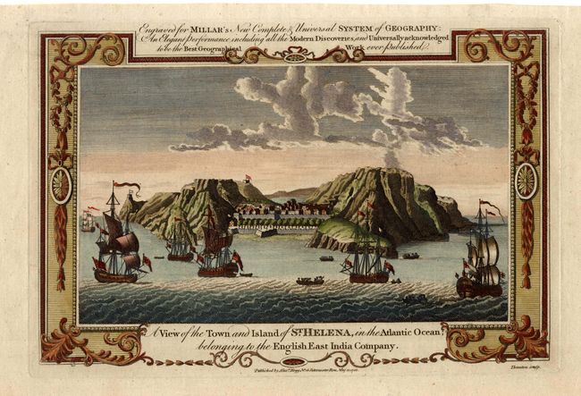
“A View of the Town and Island of St. Helena in the Atlantic Ocean; belonging to the English East India Company”
Map Maker:
Andrew Millar
Attractive birds-eye-view of the town and harbor, ... (full text available to subscribers)
| Item Detail |
| |
| |
MapMaker: |
Andrew Millar
|
|
| |
| |
Subject: |
St. Helena |
|
| |
Period/Size: |
1788 / 7.7" x 11.7" (19.6 x 29.8 cm)
|
|
| |
Color: |
Colored
|
|
| |
Condition: |
(A) Dark impression and good color. (condition help) |
|
| |
Source: |
New Complete & Universal System of Geography |
|
| |
References: |
|
|
| |
|
|
| Sales Information |
| |
| |
Price: |
|
|
| |
| |
Offered by: |
Old World Auctions |
|
| |
Catalog: |
Auction No. 104 - Antique Maps, Charts, Atlases & Globes (351) |
|
| |
Lot/Item #: |
326 |
|
| |
| |
Date: |
09/2003
|
|
| |
| |
|
Antique Maps - Valuation and Pricing, Descriptions, Resources |
|
Home |
Information |
Search |
Register |
Contact Us |
Site Map
Americana Exchange, Inc. © 1999 - 2024 Americana Exchange, Inc.. All rights reserved.
OldMaps.com, the OldMaps.com logo and
AMPR are service marks or registered service marks of Americana Exchange, Inc..
|