Title:
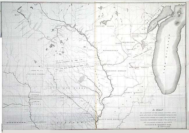
“A Map of a Portion of the Indian Country Lying East and West of the Mississippi River to the Forty Six Degree of North Latitude From Personal Observation made in the Autumn of 1835 and Recent Authentic Documents …”
Map Maker:
U.S. Government
Interesting map centered primarily in Iowa, with p... (full text available to subscribers)
| Item Detail |
| |
| |
MapMaker: |
U.S. Government
|
|
| |
| |
Subject: |
United States - Central |
|
| |
Period/Size: |
1836 / 26.2" x 37.9" (66.6 x 96.3 cm)
|
|
| |
Color: |
Black & White
|
|
| |
Condition: |
(B) Toned at joint and trimmed to neatline at binding side, else very fine. (condition help) |
|
| |
Source: |
Report of a geological reconnaissance…to the Coteau de Prairie |
|
| |
References: |
Claussen & Friis #94. |
|
| |
|
|
| Sales Information |
| |
| |
Price: |
|
|
| |
| |
Offered by: |
Old World Auctions |
|
| |
Catalog: |
Auction No. 104 - Antique Maps, Charts, Atlases & Globes (351) |
|
| |
Lot/Item #: |
176 |
|
| |
| |
Date: |
09/2003
|
|
| |
| |
|
Antique Maps - Valuation and Pricing, Descriptions, Resources |
|
Home |
Information |
Search |
Register |
Contact Us |
Site Map
Americana Exchange, Inc. © 1999 - 2024 Americana Exchange, Inc.. All rights reserved.
OldMaps.com, the OldMaps.com logo and
AMPR are service marks or registered service marks of Americana Exchange, Inc..
|