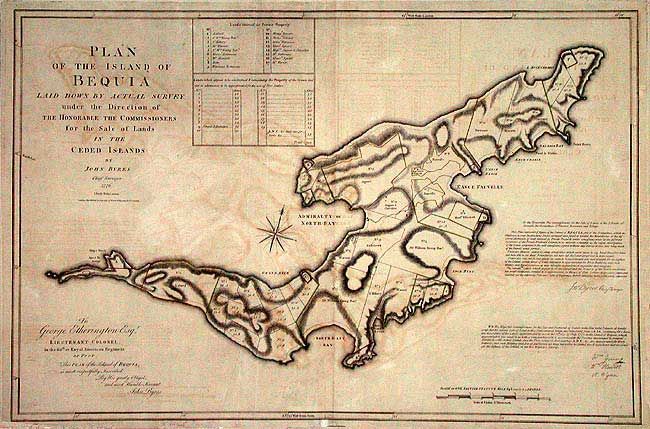
Title:
“Plan of the Island of Bequia Laid Down by Actual Survey under the Direction of The Honorable The Commissioners for the Sale of Lands in the Ceded Islands”
Map Maker:
Robert Wilkinson
Large-scale plan of the present-day upscale touris... (full text available to subscribers)
| Item Detail |
| |
| |
MapMaker: |
Robert Wilkinson
|
|
| |
| |
Subject: |
Lesser Antilles |
|
| |
Period/Size: |
1776 / 24.5" x 35.5" (62.3 x 90.2 cm)
|
|
| |
Color: |
Colored
|
|
| |
Condition: |
(B) Good impression with some offsetting and age toning. (condition help) |
|
| |
Source: |
|
|
| |
References: |
|
|
| |
|
|
| Sales Information |
| |
| |
Price: |
|
|
| |
| |
Offered by: |
Old World Auctions |
|
| |
Catalog: |
Auction No. 104 - Antique Maps, Charts, Atlases & Globes (351) |
|
| |
Lot/Item #: |
284 |
|
| |
| |
Date: |
09/2003
|
|
| |
| |
|
Antique Maps - Valuation and Pricing, Descriptions, Resources |
|
Home |
Information |
Search |
Register |
Contact Us |
Site Map
Americana Exchange, Inc. © 1999 - 2024 Americana Exchange, Inc.. All rights reserved.
OldMaps.com, the OldMaps.com logo and
AMPR are service marks or registered service marks of Americana Exchange, Inc..
|