| Item Detail |
| |
| |
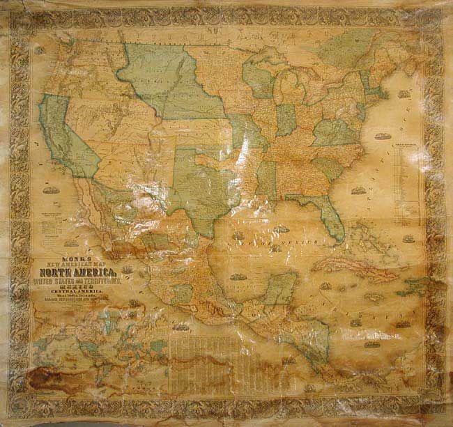
MapMaker: |
Jacob Monk
|
|
| |
| |
Subject: |
United States - Wall Map |
|
| |
Period/Size: |
1856 / 60.0" x 57.0" (152.4 x 144.8 cm)
|
|
| |
Color: |
Colored
|
|
| |
Condition: |
(B) Varnish slightly darkened, as usual, with some light tidemarks at edges and darker damp stains in world map inset. Occasional cracks, mostly in bottom. All surface intact and surprisingly good. Despite flaws, overall good and deserving of conservat (condition help) |
|
| |
Source: |
|
|
| |
References: |
cf Wheat (TMW) 794; Wheat (GOLD) 243; Rumsey 602. |
|
| |
|
|
| Sales Information |
| |
| |
Price: |
|
|
| |
| |
Offered by: |
Old World Auctions |
|
| |
Catalog: |
Auction No. 104 - Antique Maps, Charts, Atlases & Globes (351) |
|
| |
Lot/Item #: |
160 |
|
| |
| |
Date: |
09/2003
|
|
| |
| |
|