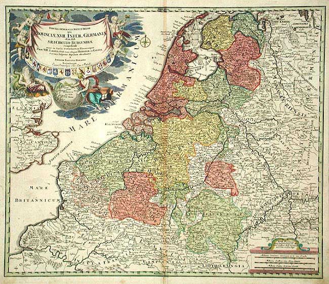
Title:
“Tabula Generalis Totius Belgii qua Provinciae, XVII. Infer. Germaniae olim sub S. R.I. Circulo Burgundiae…”
Map Maker:
Johann Baptist Homann
Fine map of the region filled with detail. The la... (full text available to subscribers)
| Item Detail |
| |
| |
MapMaker: |
Johann Baptist Homann
|
|
| |
| |
Subject: |
The Netherlands, Belgium and Luxembourg |
|
| |
Period/Size: |
1720 / 18.9" x 22.2" (48.0 x 56.4 cm)
|
|
| |
Color: |
Colored
|
|
| |
Condition: |
(B) Slight toning at fold with tissue repair on bottom separation, just entering border. (condition help) |
|
| |
Source: |
|
|
| |
References: |
|
|
| |
|
|
| Sales Information |
| |
| |
Price: |
|
|
| |
| |
Offered by: |
Old World Auctions |
|
| |
Catalog: |
Auction No. 104 - Antique Maps, Charts, Atlases & Globes (351) |
|
| |
Lot/Item #: |
409 |
|
| |
| |
Date: |
09/2003
|
|
| |
| |
|
Antique Maps - Valuation and Pricing, Descriptions, Resources |
|
Home |
Information |
Search |
Register |
Contact Us |
Site Map
Americana Exchange, Inc. © 1999 - 2024 Americana Exchange, Inc.. All rights reserved.
OldMaps.com, the OldMaps.com logo and
AMPR are service marks or registered service marks of Americana Exchange, Inc..
|