| Item Detail |
| |
| |
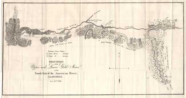
MapMaker: |
Anonymous
|
|
| |
| |
Subject: |
California |
|
| |
Period/Size: |
1848 / 9.5" x 18.3" (24.2 x 46.4 cm)
|
|
| |
Color: |
Black & White
|
|
| |
Condition: |
(A) Folding with narrow margin on binding side, as issued. Two small spots, otherwise a fine and very clean example. (condition help) |
|
| |
Source: |
Col. Richard b. Mason's Report (HR Doc, No. 1, 30th Congress, Second Session) |
|
| |
References: |
Wheat (Gold) #51. |
|
| |
|
|
| Sales Information |
| |
| |
Price: |
|
|
| |
| |
Offered by: |
Old World Auctions |
|
| |
Catalog: |
Auction No. 104 - Antique Maps, Charts, Atlases & Globes (351) |
|
| |
Lot/Item #: |
204 |
|
| |
| |
Date: |
09/2003
|
|
| |
| |
|