| Item Detail |
| |
| |
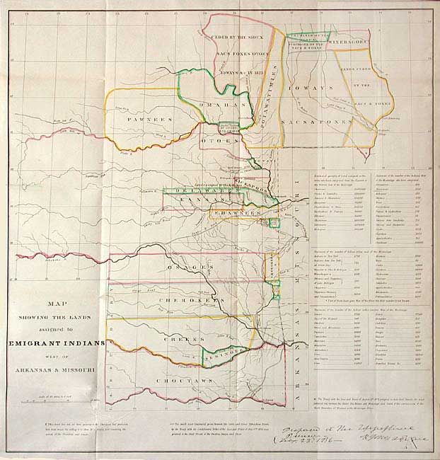
MapMaker: |
U.S. Government
|
|
| |
| |
Subject: |
United States - Central |
|
| |
Period/Size: |
1836 / 18.5" x 17.7" (47.0 x 45.0 cm)
|
|
| |
Color: |
Colored
|
|
| |
Condition: |
(A+) Fine example with original color and good margins all around. Slight soil in right margin, still fine. Folding, as issued. (condition help) |
|
| |
Source: |
Report of the Dragoons under command of Colonel Henry Dodge |
|
| |
References: |
Claussen & Friis #127; Wagner-Camp #63; Wheat [TMW] #412. |
|
| |
|
|
| Sales Information |
| |
| |
Price: |
|
|
| |
| |
Offered by: |
Old World Auctions |
|
| |
Catalog: |
Auction No. 104 - Antique Maps, Charts, Atlases & Globes (351) |
|
| |
Lot/Item #: |
174 |
|
| |
| |
Date: |
09/2003
|
|
| |
| |
|