Title:
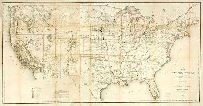
“Map of the United States and Territories Showing the extent of Public Surveys and other details constructed from the Plats and official sources of the General Land Office…”
Map Maker:
General Land Office
This map, in full original hand color, is one of t... (full text available to subscribers)
| Item Detail |
| |
| |
MapMaker: |
General Land Office
|
|
| |
| |
Subject: |
United States |
|
| |
Period/Size: |
1866 / 28.0" x 54.5" (71.2 x 138.5 cm)
|
|
| |
Color: |
Colored
|
|
| |
Condition: |
(B) Fine impression and coloring. Issued folding, now backed with archival tissue. Toned along some folds, else very good. (condition help) |
|
| |
Source: |
Annual Report of the Commr. Genl. Land Office |
|
| |
References: |
Wheat (TMW) 1137; Phillips (A) 1388-23. |
|
| |
|
|
| Sales Information |
| |
| |
Price: |
|
|
| |
| |
Offered by: |
Old World Auctions |
|
| |
Catalog: |
Auction No. 105 - Antique Maps, Charts, Atlases & Globes (358) |
|
| |
Lot/Item #: |
136 |
|
| |
| |
Date: |
12/2003
|
|
| |
| |
|
Antique Maps - Valuation and Pricing, Descriptions, Resources |
|
Home |
Information |
Search |
Register |
Contact Us |
Site Map
Americana Exchange, Inc. © 1999 - 2024 Americana Exchange, Inc.. All rights reserved.
OldMaps.com, the OldMaps.com logo and
AMPR are service marks or registered service marks of Americana Exchange, Inc..
|