Title:
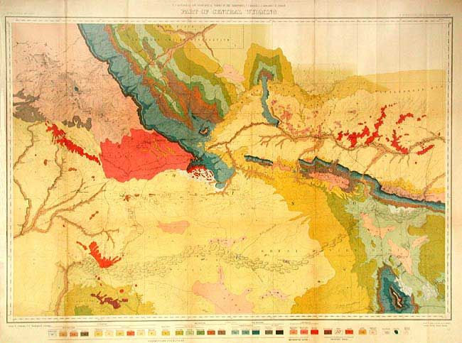
“U.S. Geological and Geographical Survey of the Territories,…Part of Central Wyoming”
Map Maker:
U.S. Geographical Survey
This striking map covers an area south of the Shos... (full text available to subscribers)
| Item Detail |
| |
| |
MapMaker: |
U.S. Geographical Survey
|
|
| |
| |
Subject: |
Wyoming |
|
| |
Period/Size: |
1877 / 22.7" x 33.5" (57.7 x 85.1 cm)
|
|
| |
Color: |
Colored
|
|
| |
Condition: |
(A) Issued folding, now backed with archival tissue. Lightly toned along one fold. (condition help) |
|
| |
Source: |
|
|
| |
References: |
|
|
| |
|
|
| Sales Information |
| |
| |
Price: |
|
|
| |
| |
Offered by: |
Old World Auctions |
|
| |
Catalog: |
Auction No. 105 - Antique Maps, Charts, Atlases & Globes (358) |
|
| |
Lot/Item #: |
224 |
|
| |
| |
Date: |
12/2003
|
|
| |
| |
|
Antique Maps - Valuation and Pricing, Descriptions, Resources |
|
Home |
Information |
Search |
Register |
Contact Us |
Site Map
Americana Exchange, Inc. © 1999 - 2024 Americana Exchange, Inc.. All rights reserved.
OldMaps.com, the OldMaps.com logo and
AMPR are service marks or registered service marks of Americana Exchange, Inc..
|