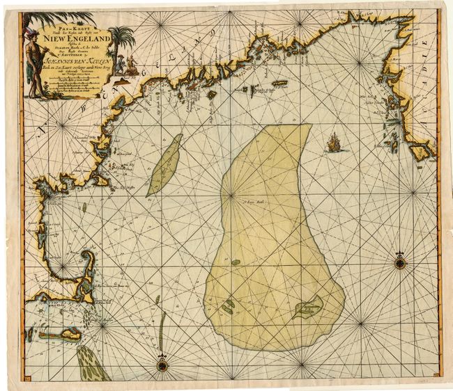
Title:
“Pas-kaart Vande Zee Kusten inde Boght van Niew Engeland Tusschen de Staaten Hoek en C. de Sable…”
Map Maker:
Johannes van Keulen
One of the earliest obtainable sea charts of the N... (full text available to subscribers)
| Item Detail |
| |
| |
MapMaker: |
Johannes van Keulen
|
|
| |
| |
Subject: |
Colonial New England |
|
| |
Period/Size: |
1684 / 20.2" x 23.0" (51.3 x 58.5 cm)
|
|
| |
Color: |
Colored
|
|
| |
Condition: |
(B) Clean and bright with a sharp impression and nice color. Two small wormholes on centerfold, not affecting printed surface. A few chips at paper edges. (condition help) |
|
| |
Source: |
De Niewe Groot Lichtende Zee-Fakkel |
|
| |
References: |
McCorkle #684.2. |
|
| |
|
|
| Sales Information |
| |
| |
Price: |
|
|
| |
| |
Offered by: |
Old World Auctions |
|
| |
Catalog: |
Auction No. 105 - Antique Maps, Charts, Atlases & Globes (358) |
|
| |
Lot/Item #: |
106 |
|
| |
| |
Date: |
12/2003
|
|
| |
| |
|
Antique Maps - Valuation and Pricing, Descriptions, Resources |
|
Home |
Information |
Search |
Register |
Contact Us |
Site Map
Americana Exchange, Inc. © 1999 - 2024 Americana Exchange, Inc.. All rights reserved.
OldMaps.com, the OldMaps.com logo and
AMPR are service marks or registered service marks of Americana Exchange, Inc..
|