Title:
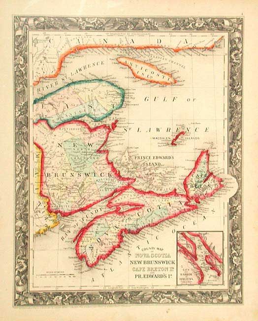
“County Map of Nova Scotia, New Brunswick, Cape Breton Id. and Prince Edward's Id.”
Map Maker:
Samuel Augustus Mitchell
First edition of this lovely steel engraved chart ... (full text available to subscribers)
| Item Detail |
| |
| |
MapMaker: |
Samuel Augustus Mitchell
|
|
| |
| |
Subject: |
Canada |
|
| |
Period/Size: |
1860 / 13.2" x 10.6" (33.6 x 27.0 cm)
|
|
| |
Color: |
Colored
|
|
| |
Condition: |
(A) Early and fine impression with bright original color and full margins. (condition help) |
|
| |
Source: |
|
|
| |
References: |
|
|
| |
|
|
| Sales Information |
| |
| |
Price: |
|
|
| |
| |
Offered by: |
Old World Auctions |
|
| |
Catalog: |
Auction No. 105 - Antique Maps, Charts, Atlases & Globes (358) |
|
| |
Lot/Item #: |
119 |
|
| |
| |
Date: |
12/2003
|
|
| |
| |
|
Antique Maps - Valuation and Pricing, Descriptions, Resources |
|
Home |
Information |
Search |
Register |
Contact Us |
Site Map
Americana Exchange, Inc. © 1999 - 2024 Americana Exchange, Inc.. All rights reserved.
OldMaps.com, the OldMaps.com logo and
AMPR are service marks or registered service marks of Americana Exchange, Inc..
|