Title:
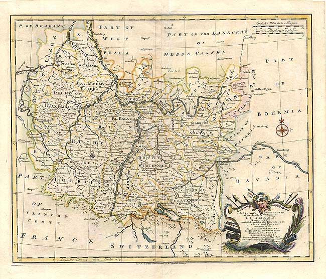
“A New and Correct Map of the South West part of Germany…Mentz and Triers…Palatinate of the Rhine…Wirtemberg, Franconia, Swabia, Alsace, Lorrain, &c.”
Map Maker:
Emanuel Bowen
Handsome and detailed map with the Rhine River at ... (full text available to subscribers)
| Item Detail |
| |
| |
MapMaker: |
Emanuel Bowen
|
|
| |
| |
Subject: |
Germany |
|
| |
Period/Size: |
1732 / 13.5" x 16.7" (34.3 x 42.5 cm)
|
|
| |
Color: |
Colored
|
|
| |
Condition: |
(B) Good impression and coloring on thick paper with watermark. Faint offsetting and a few spots, else very good. (condition help) |
|
| |
Source: |
Tindal's Continuation of Rapin's History of England |
|
| |
References: |
|
|
| |
|
|
| Sales Information |
| |
| |
Price: |
|
|
| |
| |
Offered by: |
Old World Auctions |
|
| |
Catalog: |
Auction No. 105 - Antique Maps, Charts, Atlases & Globes (358) |
|
| |
Lot/Item #: |
408 |
|
| |
| |
Date: |
12/2003
|
|
| |
| |
|
Antique Maps - Valuation and Pricing, Descriptions, Resources |
|
Home |
Information |
Search |
Register |
Contact Us |
Site Map
Americana Exchange, Inc. © 1999 - 2024 Americana Exchange, Inc.. All rights reserved.
OldMaps.com, the OldMaps.com logo and
AMPR are service marks or registered service marks of Americana Exchange, Inc..
|