Title:
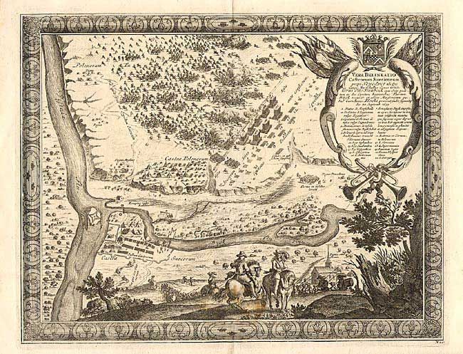
“Vera Delineatio Castrorum Suecicorum prope Nowodwor…”
Map Maker:
Samuel von Pufendorf
Bird's-eye plan of the Swedish and Polish forces g... (full text available to subscribers)
| Item Detail |
| |
| |
MapMaker: |
Samuel von Pufendorf
|
|
| |
| |
Subject: |
Poland |
|
| |
Period/Size: |
1697 / 11.0" x 14.2" (28.0 x 36.1 cm)
|
|
| |
Color: |
Black & White
|
|
| |
Condition: |
(B) Small stains at bottom center. (condition help) |
|
| |
Source: |
Histoire du regne de Charles Gustave, roy de Suede |
|
| |
References: |
|
|
| |
|
|
| Sales Information |
| |
| |
Price: |
|
|
| |
| |
Offered by: |
Old World Auctions |
|
| |
Catalog: |
Auction No. 105 - Antique Maps, Charts, Atlases & Globes (358) |
|
| |
Lot/Item #: |
397 |
|
| |
| |
Date: |
12/2003
|
|
| |
| |
|
Antique Maps - Valuation and Pricing, Descriptions, Resources |
|
Home |
Information |
Search |
Register |
Contact Us |
Site Map
Americana Exchange, Inc. © 1999 - 2024 Americana Exchange, Inc.. All rights reserved.
OldMaps.com, the OldMaps.com logo and
AMPR are service marks or registered service marks of Americana Exchange, Inc..
|