Title:
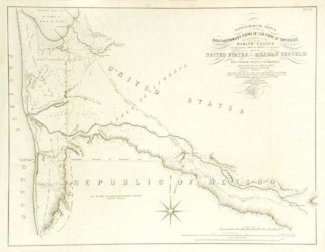
“Topographical Sketch of the Southernmost Part of the Port of San Diego, and measurement of the Marine League for determining Initial Point of Boundary between the United States and Mexican Republic as Surveyed by The United States Commission…”
Map Maker:
U.S. Government
This was the critical map of the Mexican boundary ... (full text available to subscribers)
| Item Detail |
| |
| |
MapMaker: |
U.S. Government
|
|
| |
| |
Subject: |
California & Mexico |
|
| |
Period/Size: |
1849 / 17.5" x 22.7" (44.5 x 57.7 cm)
|
|
| |
Color: |
Black & White
|
|
| |
Condition: |
(A) Issued folding, now backed with archival tissue. (condition help) |
|
| |
Source: |
Senate Doc. 34, 31st Cong., 1st Sess. |
|
| |
References: |
Wheat (TWM) 616. |
|
| |
|
|
| Sales Information |
| |
| |
Price: |
|
|
| |
| |
Offered by: |
Old World Auctions |
|
| |
Catalog: |
Auction No. 105 - Antique Maps, Charts, Atlases & Globes (358) |
|
| |
Lot/Item #: |
229 |
|
| |
| |
Date: |
12/2003
|
|
| |
| |
|
Antique Maps - Valuation and Pricing, Descriptions, Resources |
|
Home |
Information |
Search |
Register |
Contact Us |
Site Map
Americana Exchange, Inc. © 1999 - 2024 Americana Exchange, Inc.. All rights reserved.
OldMaps.com, the OldMaps.com logo and
AMPR are service marks or registered service marks of Americana Exchange, Inc..
|