Title:
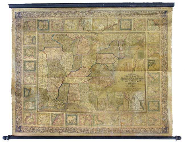
“Mitchell's National Map of the American Republic or United States of North America Together with Maps of the Vicinities of Thirty-Two of the Principal Cities and Towns in the Union”
Map Maker:
Samuel Augustus Mitchell
Very fine wall map drawn by J.H. Young and engrave... (full text available to subscribers)
| Item Detail |
| |
| |
MapMaker: |
Samuel Augustus Mitchell
|
|
| |
| |
Subject: |
United States |
|
| |
Period/Size: |
1846 / 37.0" x 47.5" (94.0 x 120.7 cm)
|
|
| |
Color: |
Black & White
|
|
| |
Condition: |
(A) Large but light stain in upper portion of map that extends into some of the city plans surrounding, but not into the map itself. Complete with original wooden rollers. (condition help) |
|
| |
Source: |
|
|
| |
References: |
|
|
| |
|
|
| Sales Information |
| |
| |
Price: |
|
|
| |
| |
Offered by: |
Old World Auctions |
|
| |
Catalog: |
Auction No. 105 - Antique Maps, Charts, Atlases & Globes (358) |
|
| |
Lot/Item #: |
132 |
|
| |
| |
Date: |
12/2003
|
|
| |
| |
|
Antique Maps - Valuation and Pricing, Descriptions, Resources |
|
Home |
Information |
Search |
Register |
Contact Us |
Site Map
Americana Exchange, Inc. © 1999 - 2024 Americana Exchange, Inc.. All rights reserved.
OldMaps.com, the OldMaps.com logo and
AMPR are service marks or registered service marks of Americana Exchange, Inc..
|