Title:
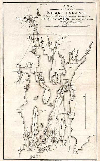
“A map of Part of Rhode Island, Shewing the Position of the American & British Armies at the Siege of Newport, & the subsequent Action on the 29th of August 1778”
Map Maker:
Richard Phillips
A copper engraved Revolutionary War plan th... (full text available to subscribers)
| Item Detail |
| |
| |
MapMaker: |
Richard Phillips
|
|
| |
| |
Subject: |
Rhode Island |
|
| |
Period/Size: |
1806 / 16.7" x 10.0" (42.5 x 25.4 cm)
|
|
| |
Color: |
Black & White
|
|
| |
Condition: |
(B) Good impression on thick paper. A little very light scattered toning, one tiny hole near center, else very good. Short area of margin added to binding side, away from border. (condition help) |
|
| |
Source: |
Marshall's Life of Washington |
|
| |
References: |
|
|
| |
|
|
| Sales Information |
| |
| |
Price: |
|
|
| |
| |
Offered by: |
Old World Auctions |
|
| |
Catalog: |
Auction No. 105 - Antique Maps, Charts, Atlases & Globes (358) |
|
| |
Lot/Item #: |
216 |
|
| |
| |
Date: |
12/2003
|
|
| |
| |
|
Antique Maps - Valuation and Pricing, Descriptions, Resources |
|
Home |
Information |
Search |
Register |
Contact Us |
Site Map
Americana Exchange, Inc. © 1999 - 2024 Americana Exchange, Inc.. All rights reserved.
OldMaps.com, the OldMaps.com logo and
AMPR are service marks or registered service marks of Americana Exchange, Inc..
|