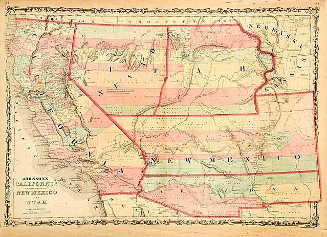
Title:
“Johnson's California Territories of New Mexico and Utah”
Map Maker:
Johnson & Browning
A nice example of this early map from Johnson's So... (full text available to subscribers)
| Item Detail |
| |
| |
MapMaker: |
Johnson & Browning
|
|
| |
| |
Subject: |
Southwestern United States |
|
| |
Period/Size: |
1861 / 16.8" x 24.0" (42.7 x 61.0 cm)
|
|
| |
Color: |
Colored
|
|
| |
Condition: |
(B) Short splits on centerfold just entering map. The one at top includes a small 'V' shaped paper loss that affects a tiny part of the engraved border. (condition help) |
|
| |
Source: |
Illustrated Atlas |
|
| |
References: |
Wheat: [TMW] #1027. |
|
| |
|
|
| Sales Information |
| |
| |
Price: |
|
|
| |
| |
Offered by: |
Old World Auctions |
|
| |
Catalog: |
Auction No. 105 - Antique Maps, Charts, Atlases & Globes (358) |
|
| |
Lot/Item #: |
159 |
|
| |
| |
Date: |
12/2003
|
|
| |
| |
|
Antique Maps - Valuation and Pricing, Descriptions, Resources |
|
Home |
Information |
Search |
Register |
Contact Us |
Site Map
Americana Exchange, Inc. © 1999 - 2024 Americana Exchange, Inc.. All rights reserved.
OldMaps.com, the OldMaps.com logo and
AMPR are service marks or registered service marks of Americana Exchange, Inc..
|