Title:
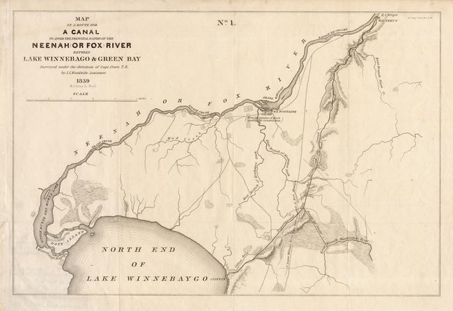
“Map of a Route for a Canal to avoid the principal rapids of the Neenah (Or Fox) River between lake Winnebago & Green Bay”
Map Maker:
U.S. Government
Interesting map showing the proposed improvements ... (full text available to subscribers)
| Item Detail |
| |
| |
MapMaker: |
U.S. Government
|
|
| |
| |
Subject: |
Wisconsin |
|
| |
Period/Size: |
1839 / 10.4" x 15.2" (26.5 x 38.6 cm)
|
|
| |
Color: |
Black & White
|
|
| |
Condition: |
(A) Margin extended at binding side. (condition help) |
|
| |
Source: |
Sen. Doc. 318, Report from the Secretary of War. |
|
| |
References: |
Claussen & Friis #34. |
|
| |
|
|
| Sales Information |
| |
| |
Price: |
|
|
| |
| |
Offered by: |
Old World Auctions |
|
| |
Catalog: |
Auction No. 106 - Antique Maps, Charts, Atlases & Globes (359) |
|
| |
Lot/Item #: |
227 |
|
| |
| |
Date: |
03/2003
|
|
| |
| |
|
Antique Maps - Valuation and Pricing, Descriptions, Resources |
|
Home |
Information |
Search |
Register |
Contact Us |
Site Map
Americana Exchange, Inc. © 1999 - 2024 Americana Exchange, Inc.. All rights reserved.
OldMaps.com, the OldMaps.com logo and
AMPR are service marks or registered service marks of Americana Exchange, Inc..
|