Title:
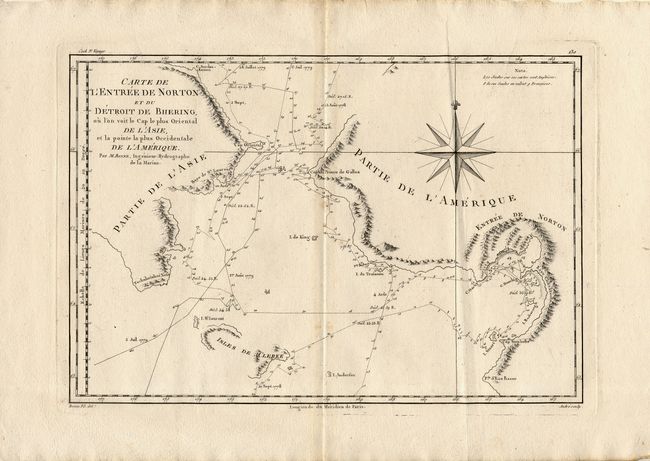
“Carte de l' Entree de Norton et du Detroit de Bhering, ou l'on voit le cap le plus Oriental de l' Asie et la pointe la plus Occidentale de l' Amerique”
Map Maker:
Rigobert Bonne
Great map of the Bering Strait from the coast sout... (full text available to subscribers)
| Item Detail |
| |
| |
MapMaker: |
Rigobert Bonne
|
|
| |
| |
Subject: |
North Pacific |
|
| |
Period/Size: |
1788 / 9.2" x 13.5" (23.4 x 34.3 cm)
|
|
| |
Color: |
Black & White
|
|
| |
Condition: |
(B) Crisp impression with faint toning along fold. (condition help) |
|
| |
Source: |
Atlas Encyclopedique |
|
| |
References: |
Falk #1788-2. |
|
| |
|
|
| Sales Information |
| |
| |
Price: |
|
|
| |
| |
Offered by: |
Old World Auctions |
|
| |
Catalog: |
Auction No. 106 - Antique Maps, Charts, Atlases & Globes (359) |
|
| |
Lot/Item #: |
541 |
|
| |
| |
Date: |
03/2003
|
|
| |
| |
|
Antique Maps - Valuation and Pricing, Descriptions, Resources |
|
Home |
Information |
Search |
Register |
Contact Us |
Site Map
Americana Exchange, Inc. © 1999 - 2024 Americana Exchange, Inc.. All rights reserved.
OldMaps.com, the OldMaps.com logo and
AMPR are service marks or registered service marks of Americana Exchange, Inc..
|