Title:
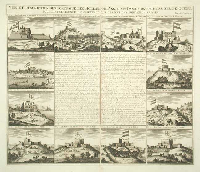
“Vue et Description des Forts que les Hollandois, Angloise et Danois ont sur la Cote de Guinee…”
Map Maker:
Henry Abraham Chatelain
An interesting folio sheet with twelve views of fo... (full text available to subscribers)
| Item Detail |
| |
| |
MapMaker: |
Henry Abraham Chatelain
|
|
| |
| |
Subject: |
Africa - Western |
|
| |
Period/Size: |
1720 / 14.5" x 16.7" (36.9 x 42.5 cm)
|
|
| |
Color: |
Black & White
|
|
| |
Condition: |
(B) Sharp impression with light toning along fold with a short fold separation closed with archival tape. (condition help) |
|
| |
Source: |
|
|
| |
References: |
|
|
| |
|
|
| Sales Information |
| |
| |
Price: |
|
|
| |
| |
Offered by: |
Old World Auctions |
|
| |
Catalog: |
Auction No. 106 - Antique Maps, Charts, Atlases & Globes (359) |
|
| |
Lot/Item #: |
532 |
|
| |
| |
Date: |
03/2003
|
|
| |
| |
|
Antique Maps - Valuation and Pricing, Descriptions, Resources |
|
Home |
Information |
Search |
Register |
Contact Us |
Site Map
Americana Exchange, Inc. © 1999 - 2024 Americana Exchange, Inc.. All rights reserved.
OldMaps.com, the OldMaps.com logo and
AMPR are service marks or registered service marks of Americana Exchange, Inc..
|