Rister or Sign In to see pricing information


Title:

Map No. 2 From the Pimas Villages to Fort Fillmore…

Map Maker:

John Grubb Parke

Map No. 2  From the Pimas Villages to Fort Fillmore…

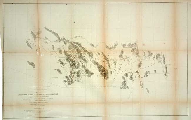
Well-engraved map from the southern most railroad ... (full text available to subscribers)
Item Detail
 
  MapMaker:  

John Grubb Parke


  Subject:  United States - Southwestern  
  Period/Size:  1854-55 / 24.0" x 38.7"  (61.0 x 98.3 cm)  
  Color:  Black & White  
  Condition:  (B) A few spots and toned along some folds. Issued folding, now tissue backed (condition help)  
  Source:  U.S. Pacific Railroad Surveys  
  References:  Wheat (TMW) #851.  
 
 
Sales Information
 
  Price: 

Please register your email to view records, or sign in with email address to see records


  Offered by:  Old World Auctions  
  Catalog:  Auction No. 106 - Antique Maps, Charts, Atlases & Globes (359)  
  Lot/Item #:  162  
 
  Date:  03/2003  


Antique Maps - Valuation and Pricing, Descriptions, Resources


Home | Information | Search | Register | Contact Us | Site Map

Americana Exchange, Inc. © 1999 - 2024 Americana Exchange, Inc.. All rights reserved. OldMaps.com, the OldMaps.com logo and
AMPR are service marks or registered service marks of Americana Exchange, Inc..