Rister or Sign In to see pricing information


Title:

Les Isles Britanniques Comprenant les Royaumes d' Angleterre, d' Ecossee et d' Irlande Divises en Grandes Provinces

Map Maker:

Jean Janvier

Les Isles Britanniques Comprenant les Royaumes d' Angleterre, d' Ecossee et d' Irlande Divises en Grandes Provinces

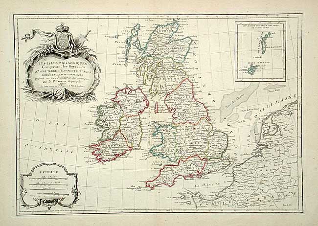
Nicely engraved chart of the islands with an inset... (full text available to subscribers)
Item Detail
 
  MapMaker:  

Jean Janvier


  Subject:  Britain  
  Period/Size:  1770 / 12.1" x 17.4"  (30.8 x 44.2 cm)  
  Color:  Colored  
  Condition:  (A) On thick paper with full margins. Very lightly toned along centerfold and a couple small spots, still very good. (condition help)  
  Source:  Atlas Moderne  
  References:   
 
 
Sales Information
 
  Price: 

Please register your email to view records, or sign in with email address to see records


  Offered by:  Old World Auctions  
  Catalog:  Auction No. 106 - Antique Maps, Charts, Atlases & Globes (359)  
  Lot/Item #:  292  
 
  Date:  03/2003  


Antique Maps - Valuation and Pricing, Descriptions, Resources


Home | Information | Search | Register | Contact Us | Site Map

Americana Exchange, Inc. © 1999 - 2024 Americana Exchange, Inc.. All rights reserved. OldMaps.com, the OldMaps.com logo and
AMPR are service marks or registered service marks of Americana Exchange, Inc..