Title:
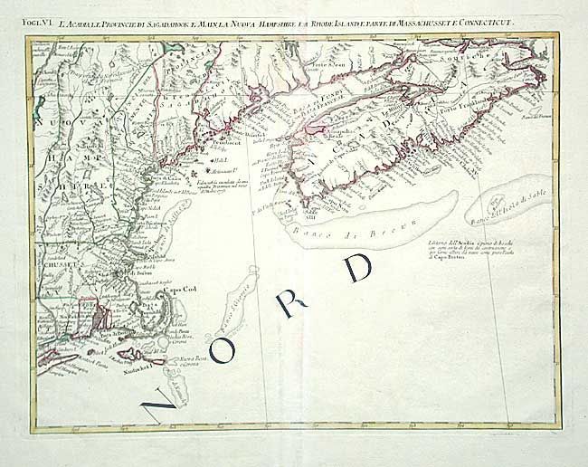
“L'Acadia, le Provincie di Sagadahook E. Main, la Nuova Hampshire, la Rhode Island, e Parte di Massachusset e Connecticut.”
Map Maker:
Antonio Zatta
This map of New England and Nova Scotia is part of... (full text available to subscribers)
| Item Detail |
| |
| |
MapMaker: |
Antonio Zatta
|
|
| |
| |
Subject: |
Canada & United States |
|
| |
Period/Size: |
1778 / 12.5" x 16.7" (31.8 x 42.5 cm)
|
|
| |
Color: |
Colored
|
|
| |
Condition: |
(B) Crisp impression and original color. Centerfold darkened, toned with pastel. (condition help) |
|
| |
Source: |
|
|
| |
References: |
Kershaw #796; McCorkle #778.8; Sellers and Van Ee #163. |
|
| |
|
|
| Sales Information |
| |
| |
Price: |
|
|
| |
| |
Offered by: |
Old World Auctions |
|
| |
Catalog: |
Auction No. 106 - Antique Maps, Charts, Atlases & Globes (359) |
|
| |
Lot/Item #: |
120 |
|
| |
| |
Date: |
03/2003
|
|
| |
| |
|
Antique Maps - Valuation and Pricing, Descriptions, Resources |
|
Home |
Information |
Search |
Register |
Contact Us |
Site Map
Americana Exchange, Inc. © 1999 - 2024 Americana Exchange, Inc.. All rights reserved.
OldMaps.com, the OldMaps.com logo and
AMPR are service marks or registered service marks of Americana Exchange, Inc..
|