Rister or Sign In to see pricing information


Title:

Western Pacific Chart No. 2

Map Maker:

James Imray, Sr.

Western Pacific Chart No. 2

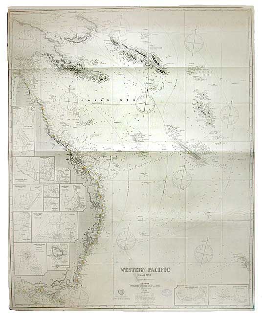
Large and well-engraved map that shows the entire ... (full text available to subscribers)
Item Detail
 
  MapMaker:  

James Imray, Sr.


  Subject:  Pacific Ocean  
  Period/Size:  1899 / 40.0" x 49.0"  (101.6 x 124.5 cm)  
  Color:  Black & White  
  Condition:  (B) Map is clean with very little damage to margins. One long, clean tear and a small clean puncture, both closed on verso. Owner's stamp below title. (condition help)  
  Source:   
  References:   
 
 
Sales Information
 
  Price: 

Please register your email to view records, or sign in with email address to see records


  Offered by:  Old World Auctions  
  Catalog:  Auction No. 106 - Antique Maps, Charts, Atlases & Globes (359)  
  Lot/Item #:  543  
 
  Date:  03/2003  


Antique Maps - Valuation and Pricing, Descriptions, Resources


Home | Information | Search | Register | Contact Us | Site Map

Americana Exchange, Inc. © 1999 - 2024 Americana Exchange, Inc.. All rights reserved. OldMaps.com, the OldMaps.com logo and
AMPR are service marks or registered service marks of Americana Exchange, Inc..