| Item Detail |
| |
| |
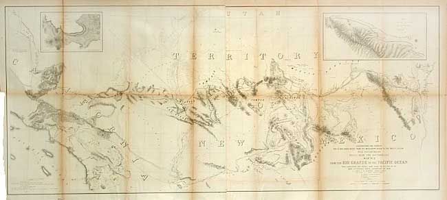
MapMaker: |
Amiel Weekes Whipple
|
|
| |
| |
Subject: |
United States - Southwestern |
|
| |
Period/Size: |
1853-54 / 21.8" x 50.5" (55.4 x 128.3 cm)
|
|
| |
Color: |
Black & White
|
|
| |
Condition: |
(B) Toned along some folds. Backed with archival tissue with a couple small intersection splits, one with very small paper loss. (condition help) |
|
| |
Source: |
U.S. Pacific Railroad Surveys |
|
| |
References: |
Wheat (TMW) #875. |
|
| |
|
|
| Sales Information |
| |
| |
Price: |
|
|
| |
| |
Offered by: |
Old World Auctions |
|
| |
Catalog: |
Auction No. 106 - Antique Maps, Charts, Atlases & Globes (359) |
|
| |
Lot/Item #: |
161 |
|
| |
| |
Date: |
03/2003
|
|
| |
| |
|