| Item Detail |
| |
| |
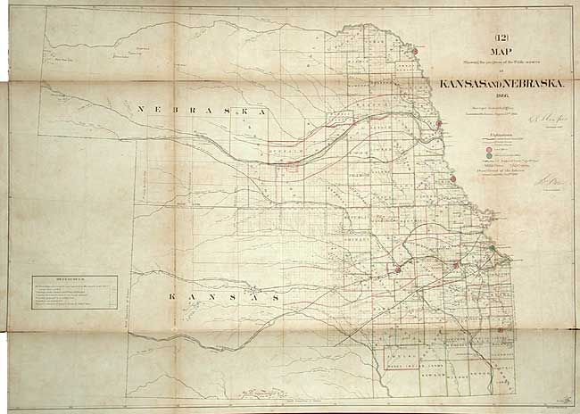
MapMaker: |
General Land Office
|
|
| |
| |
Subject: |
United States - Central |
|
| |
Period/Size: |
1866 / 23.4" x 33.0" (59.5 x 83.9 cm)
|
|
| |
Color: |
Colored
|
|
| |
Condition: |
(B) Toned along folds and some scattered foxing. Backed with linen, as issued, with some splits along folds that are closed on verso with archival tape. Binding trim into neatline at one corner. (condition help) |
|
| |
Source: |
|
|
| |
References: |
Wheat (TMW) #1151. |
|
| |
|
|
| Sales Information |
| |
| |
Price: |
|
|
| |
| |
Offered by: |
Old World Auctions |
|
| |
Catalog: |
Auction No. 107 - Antique Maps, Charts, Atlases & Globes (361) |
|
| |
Lot/Item #: |
142 |
|
| |
| |
Date: |
06/2004
|
|
| |
| |
|