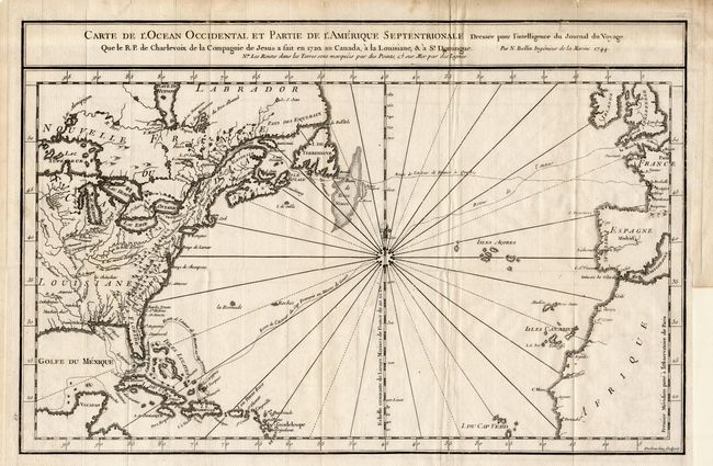
Title:
“Carte de l' Ocean Occidental et Partie de l' Amerique Septentrionale…”
Map Maker:
Jacques Nicolas Bellin
Attractive chart of the Atlantic, from about 15° N... (full text available to subscribers)
| Item Detail |
| |
| |
MapMaker: |
Jacques Nicolas Bellin
|
|
| |
| |
Subject: |
North Atlantic |
|
| |
Period/Size: |
1744 / 9.7" x 14.7" (24.7 x 37.4 cm)
|
|
| |
Color: |
Black & White
|
|
| |
Condition: |
(B) Folding as issued with a trace of offsetting, else very good. Binder's tear and a fold separation both just touching neatline. Few other minor marginal defects. (condition help) |
|
| |
Source: |
|
|
| |
References: |
|
|
| |
|
|
| Sales Information |
| |
| |
Price: |
|
|
| |
| |
Offered by: |
Old World Auctions |
|
| |
Catalog: |
Auction No. 107 - Antique Maps, Charts, Atlases & Globes (361) |
|
| |
Lot/Item #: |
275 |
|
| |
| |
Date: |
06/2004
|
|
| |
| |
|
Antique Maps - Valuation and Pricing, Descriptions, Resources |
|
Home |
Information |
Search |
Register |
Contact Us |
Site Map
Americana Exchange, Inc. © 1999 - 2024 Americana Exchange, Inc.. All rights reserved.
OldMaps.com, the OldMaps.com logo and
AMPR are service marks or registered service marks of Americana Exchange, Inc..
|