| Item Detail |
| |
| |
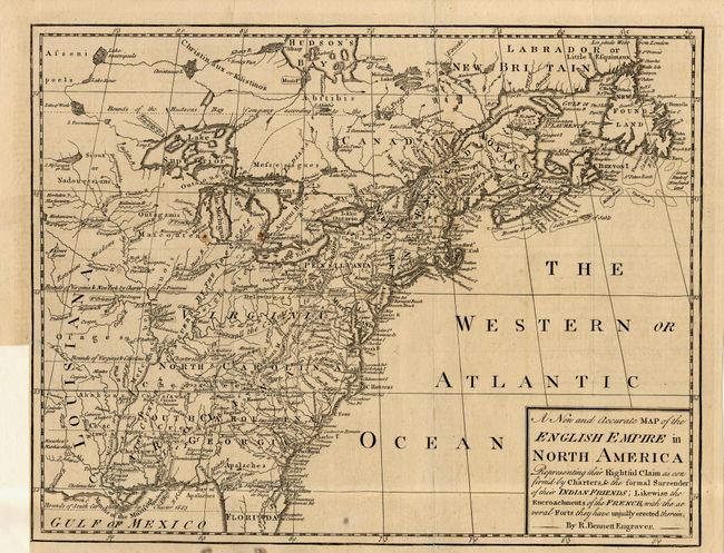
MapMaker: |
Richard Bennett
|
|
| |
| |
Subject: |
Colonial North America |
|
| |
Period/Size: |
1758 / 10.0" x 13.0" (25.4 x 33.1 cm)
|
|
| |
Color: |
Black & White
|
|
| |
Condition: |
(B) Issued folding, now pressed. Couple of small spots and tissue reinforced folds and a short binding tear. Trimmed close at binding side. (condition help) |
|
| |
Source: |
Grand Magazine of Universal Intelligence |
|
| |
References: |
Jolly GMUI-7. |
|
| |
|
|
| Sales Information |
| |
| |
Price: |
|
|
| |
| |
Offered by: |
Old World Auctions |
|
| |
Catalog: |
Auction No. 107 - Antique Maps, Charts, Atlases & Globes (361) |
|
| |
Lot/Item #: |
096 |
|
| |
| |
Date: |
06/2004
|
|
| |
| |
|