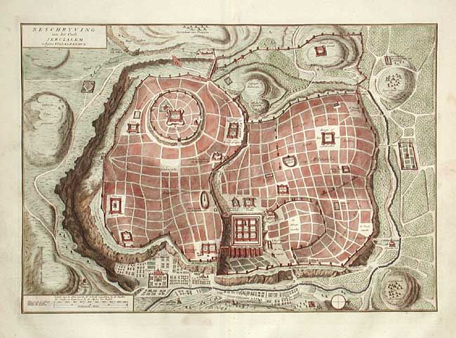
Title:
“Beschryving van het Oude Jeruzalem volgens Villalpandus”
Map Maker:
Rudolf & Gerard Wetstein
Bird's eye plan of the ancient city of Jerusalem b... (full text available to subscribers)
| Item Detail |
| |
| |
MapMaker: |
Rudolf & Gerard Wetstein
|
|
| |
| |
Subject: |
Holy Land - Jerusalem |
|
| |
Period/Size: |
1728 / 11.9" x 17.2" (30.3 x 43.7 cm)
|
|
| |
Color: |
Colored
|
|
| |
Condition: |
(A) (condition help) |
|
| |
Source: |
|
|
| |
References: |
|
|
| |
|
|
| Sales Information |
| |
| |
Price: |
|
|
| |
| |
Offered by: |
Old World Auctions |
|
| |
Catalog: |
Auction No. 107 - Antique Maps, Charts, Atlases & Globes (361) |
|
| |
Lot/Item #: |
465 |
|
| |
| |
Date: |
06/2004
|
|
| |
| |
|
Antique Maps - Valuation and Pricing, Descriptions, Resources |
|
Home |
Information |
Search |
Register |
Contact Us |
Site Map
Americana Exchange, Inc. © 1999 - 2024 Americana Exchange, Inc.. All rights reserved.
OldMaps.com, the OldMaps.com logo and
AMPR are service marks or registered service marks of Americana Exchange, Inc..
|