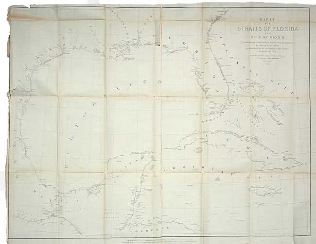
Title:
“Map of the Straits of Florida and Gulf of Mexico”
Map Maker:
Israel D. Andrews
Large folding map covering the coastline of Florid... (full text available to subscribers)
| Item Detail |
| |
| |
MapMaker: |
Israel D. Andrews
|
|
| |
| |
Subject: |
Florida and Gulf of Mexico |
|
| |
Period/Size: |
1852 / 26.2" x 34.2" (66.6 x 86.9 cm)
|
|
| |
Color: |
Black & White
|
|
| |
Condition: |
(C) Overall good for a map of this size. Minor toning at folds and a few fold intersection splits. One small tear extending 1" from fold. Joint partially detached. All easily repaired. (condition help) |
|
| |
Source: |
Communication from the Secretary of the Treasuryģ |
|
| |
References: |
|
|
| |
|
|
| Sales Information |
| |
| |
Price: |
|
|
| |
| |
Offered by: |
Old World Auctions |
|
| |
Catalog: |
Auction No. 107 - Antique Maps, Charts, Atlases & Globes (361) |
|
| |
Lot/Item #: |
221 |
|
| |
| |
Date: |
06/2004
|
|
| |
| |
|
Antique Maps - Valuation and Pricing, Descriptions, Resources |
|
Home |
Information |
Search |
Register |
Contact Us |
Site Map
Americana Exchange, Inc. © 1999 - 2024 Americana Exchange, Inc.. All rights reserved.
OldMaps.com, the OldMaps.com logo and
AMPR are service marks or registered service marks of Americana Exchange, Inc..
|