| Item Detail |
| |
| |
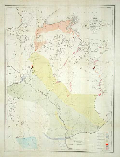
MapMaker: |
David Dale Owen
|
|
| |
| |
Subject: |
United States - Central |
|
| |
Period/Size: |
1847 / 34.0" x 25.5" (86.4 x 64.8 cm)
|
|
| |
Color: |
Colored
|
|
| |
Condition: |
(A) Good impression and fine original coloring. Issued folding, now backed with archival tissue. A little light toning along some folds and some insignificant spots, still very good for a map of this size. (condition help) |
|
| |
Source: |
Report of a Geological Reconnaissance |
|
| |
References: |
|
|
| |
|
|
| Sales Information |
| |
| |
Price: |
|
|
| |
| |
Offered by: |
Old World Auctions |
|
| |
Catalog: |
Auction No. 107 - Antique Maps, Charts, Atlases & Globes (361) |
|
| |
Lot/Item #: |
139 |
|
| |
| |
Date: |
06/2004
|
|
| |
| |
|