Title:
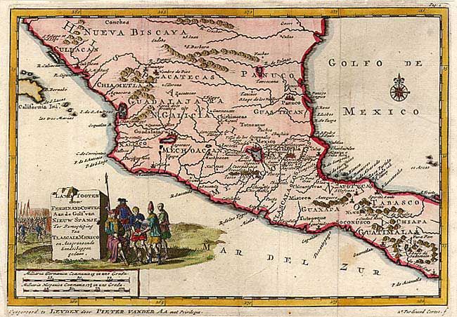
“Land Togten door Ferdinand Cortes Aan de Golf van Nieuw Spanje Ter Bemagtiging van Tlascale Mexico en Aangrenzende Landschappen gedaan”
Map Maker:
Pieter van der Aa
Finely engraved map of central Mexico. Guadalajar... (full text available to subscribers)
| Item Detail |
| |
| |
MapMaker: |
Pieter van der Aa
|
|
| |
| |
Subject: |
Mexico |
|
| |
Period/Size: |
1710 / 6.0" x 8.6" (15.3 x 21.9 cm)
|
|
| |
Color: |
Colored
|
|
| |
Condition: |
(B) Tear entering map 1" at bottom, closed with archival tape. Two faint spots. (condition help) |
|
| |
Source: |
|
|
| |
References: |
|
|
| |
|
|
| Sales Information |
| |
| |
Price: |
|
|
| |
| |
Offered by: |
Old World Auctions |
|
| |
Catalog: |
Auction No. 107 - Antique Maps, Charts, Atlases & Globes (361) |
|
| |
Lot/Item #: |
222 |
|
| |
| |
Date: |
06/2004
|
|
| |
| |
|
Antique Maps - Valuation and Pricing, Descriptions, Resources |
|
Home |
Information |
Search |
Register |
Contact Us |
Site Map
Americana Exchange, Inc. © 1999 - 2024 Americana Exchange, Inc.. All rights reserved.
OldMaps.com, the OldMaps.com logo and
AMPR are service marks or registered service marks of Americana Exchange, Inc..
|