Title:
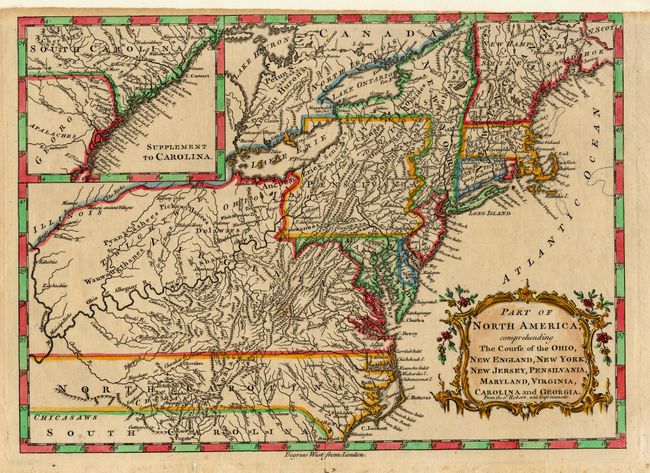
“Part of North America, comprehending The Course of the Ohio, New England, New York, New Jersey, Pensilvania, Maryland, Virginia, Carolina and Georgia. From the Sr. Robert, with Improvements”
Map Maker:
Didier Robert de Vaugondy
Based on a larger map by Robert de Vaugondy, this ... (full text available to subscribers)
| Item Detail |
| |
| |
MapMaker: |
Didier Robert de Vaugondy
|
|
| |
| |
Subject: |
Colonial North America |
|
| |
Period/Size: |
1759-60 / 8.5" x 11.7" (21.6 x 29.8 cm)
|
|
| |
Color: |
Colored
|
|
| |
Condition: |
(A) Trimmed to neatline at one corner, as issued. Modern coloring. (condition help) |
|
| |
Source: |
New Geographical Dictionary |
|
| |
References: |
McCorkle #759.2. |
|
| |
|
|
| Sales Information |
| |
| |
Price: |
|
|
| |
| |
Offered by: |
Old World Auctions |
|
| |
Catalog: |
Auction No. 107 - Antique Maps, Charts, Atlases & Globes (361) |
|
| |
Lot/Item #: |
097 |
|
| |
| |
Date: |
06/2004
|
|
| |
| |
|
Antique Maps - Valuation and Pricing, Descriptions, Resources |
|
Home |
Information |
Search |
Register |
Contact Us |
Site Map
Americana Exchange, Inc. © 1999 - 2024 Americana Exchange, Inc.. All rights reserved.
OldMaps.com, the OldMaps.com logo and
AMPR are service marks or registered service marks of Americana Exchange, Inc..
|