Rister or Sign In to see pricing information


Title:

Geological Map of the Lake Superior Land District in the State of Michigan

Map Maker:

U.S. Government

Geological Map of the Lake Superior Land District in the State of Michigan

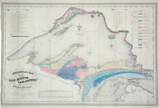
A striking map showing the geology of Upper Michig... (full text available to subscribers)
Item Detail
 
  MapMaker:  

U.S. Government


  Subject:  Michigan  
  Period/Size:  1847 / 25.7" x 39.0"  (65.3 x 99.1 cm)  
  Color:  Colored  
  Condition:  (A) Fine coloring and dark impression. Backed with archival tissue. Some light offsetting from title and a little fold toning, still very good. (condition help)  
  Source:   
  References:   
 
 
Sales Information
 
  Price: 

Please register your email to view records, or sign in with email address to see records


  Offered by:  Old World Auctions  
  Catalog:  Auction No. 107 - Antique Maps, Charts, Atlases & Globes (361)  
  Lot/Item #:  182  
 
  Date:  06/2004  


Antique Maps - Valuation and Pricing, Descriptions, Resources


Home | Information | Search | Register | Contact Us | Site Map

Americana Exchange, Inc. © 1999 - 2024 Americana Exchange, Inc.. All rights reserved. OldMaps.com, the OldMaps.com logo and
AMPR are service marks or registered service marks of Americana Exchange, Inc..