Title:
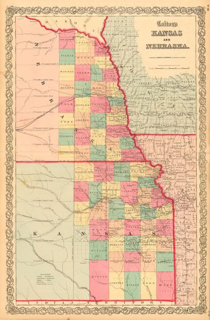
“Colton's Kansas and Nebraska”
Map Maker:
Joseph Hutchins Colton
Early map in a vertical configuration covering onl... (full text available to subscribers)
| Item Detail |
| |
| |
MapMaker: |
Joseph Hutchins Colton
|
|
| |
| |
Subject: |
Kansas and Nebraska |
|
| |
Period/Size: |
1857 / 25.5" x 16.7" (64.8 x 42.5 cm)
|
|
| |
Color: |
Colored
|
|
| |
Condition: |
(B) Bit of very unobtrusive foxing. Tiny fold separation in blank margin repaired with archival tape. (condition help) |
|
| |
Source: |
Atlas of the World |
|
| |
References: |
|
|
| |
|
|
| Sales Information |
| |
| |
Price: |
|
|
| |
| |
Offered by: |
Old World Auctions |
|
| |
Catalog: |
Auction No. 108 - Antique Maps, Charts, Atlases & Globes (362) |
|
| |
Lot/Item #: |
192 |
|
| |
| |
Date: |
09/2004
|
|
| |
| |
|
Antique Maps - Valuation and Pricing, Descriptions, Resources |
|
Home |
Information |
Search |
Register |
Contact Us |
Site Map
Americana Exchange, Inc. © 1999 - 2024 Americana Exchange, Inc.. All rights reserved.
OldMaps.com, the OldMaps.com logo and
AMPR are service marks or registered service marks of Americana Exchange, Inc..
|