Title:
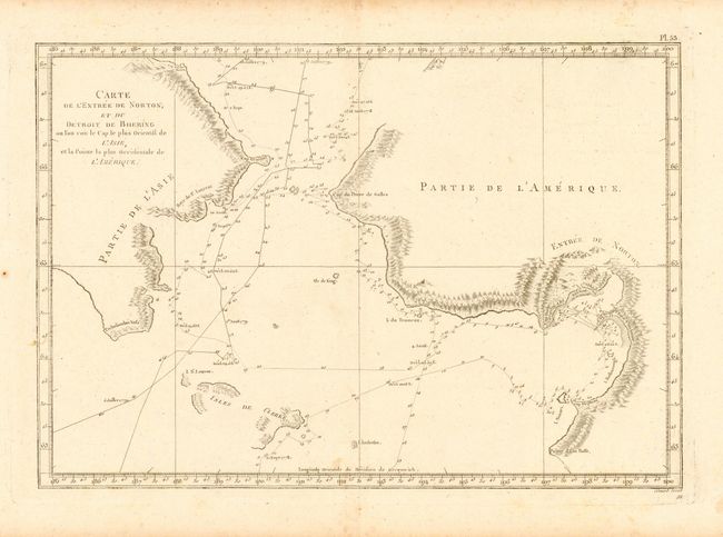
“Carte de l' Entree de Norton, et du Detroit de Bhering ou l' on voit le Cap le plus Oriental de l' Asie, et la Pointe la plus Occidentale de l' Amerique”
Map Maker:
James Cook
Nice map of the Bering Strait from the coast south... (full text available to subscribers)
| Item Detail |
| |
| |
MapMaker: |
James Cook
|
|
| |
| |
Subject: |
North Pacific Ocean |
|
| |
Period/Size: |
1785 / 10.5" x 15.2" (26.7 x 38.6 cm)
|
|
| |
Color: |
Black & White
|
|
| |
Condition: |
(B) On fine hand-laid paper with wide margins. A couple light areas of foxing, else very good. (condition help) |
|
| |
Source: |
Atlas du Troisieme Voyage de Cook |
|
| |
References: |
Robson #3.16-3.27. |
|
| |
|
|
| Sales Information |
| |
| |
Price: |
|
|
| |
| |
Offered by: |
Old World Auctions |
|
| |
Catalog: |
Auction No. 108 - Antique Maps, Charts, Atlases & Globes (362) |
|
| |
Lot/Item #: |
622 |
|
| |
| |
Date: |
09/2004
|
|
| |
| |
|
Antique Maps - Valuation and Pricing, Descriptions, Resources |
|
Home |
Information |
Search |
Register |
Contact Us |
Site Map
Americana Exchange, Inc. © 1999 - 2024 Americana Exchange, Inc.. All rights reserved.
OldMaps.com, the OldMaps.com logo and
AMPR are service marks or registered service marks of Americana Exchange, Inc..
|