Title:
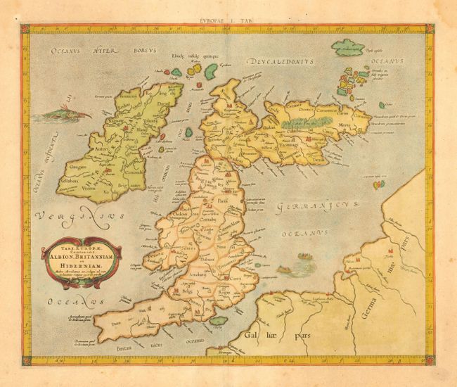
“Tab. I. Europae Continens Albion, Britanniam, et Hiberniam.”
Map Maker:
Ptolemy/Mercator
A fine Ptolemaic map of the British Isles showing ... (full text available to subscribers)
| Item Detail |
| |
| |
MapMaker: |
Ptolemy/Mercator
|
|
| |
| |
Subject: |
Britain |
|
| |
Period/Size: |
1695 / 13.2" x 16.0" (33.6 x 40.7 cm)
|
|
| |
Color: |
Colored
|
|
| |
Condition: |
(B) Lightly toned with a bit of minor foxing. Light damp stains in blank margins, not affecting map. (condition help) |
|
| |
Source: |
Claudii Ptolemaei Tabulae Geographicae Orbis Terrarum |
|
| |
References: |
Shirley, (BI) #123. |
|
| |
|
|
| Sales Information |
| |
| |
Price: |
|
|
| |
| |
Offered by: |
Old World Auctions |
|
| |
Catalog: |
Auction No. 108 - Antique Maps, Charts, Atlases & Globes (362) |
|
| |
Lot/Item #: |
306 |
|
| |
| |
Date: |
09/2004
|
|
| |
| |
|
Antique Maps - Valuation and Pricing, Descriptions, Resources |
|
Home |
Information |
Search |
Register |
Contact Us |
Site Map
Americana Exchange, Inc. © 1999 - 2024 Americana Exchange, Inc.. All rights reserved.
OldMaps.com, the OldMaps.com logo and
AMPR are service marks or registered service marks of Americana Exchange, Inc..
|