Title:
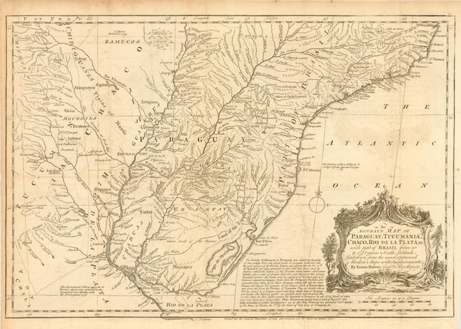
“An Accurate Map of Paraguay, Tucumania, Chaco, Rio de la Plata &c. With part of Brasil from 20 to 37 Degrees South Latitude.”
Map Maker:
Emanuel Bowen
An interesting copper engraved map showing conside... (full text available to subscribers)
| Item Detail |
| |
| |
MapMaker: |
Emanuel Bowen
|
|
| |
| |
Subject: |
Central South America |
|
| |
Period/Size: |
1746 / 11.2" x 16.5" (28.5 x 42.0 cm)
|
|
| |
Color: |
Black & White
|
|
| |
Condition: |
(B) On thick hand-laid paper, folding as issued. Tiny holes at fold intersections and very light occasional foxing, else very good. (condition help) |
|
| |
Source: |
|
|
| |
References: |
|
|
| |
|
|
| Sales Information |
| |
| |
Price: |
|
|
| |
| |
Offered by: |
Old World Auctions |
|
| |
Catalog: |
Auction No. 108 - Antique Maps, Charts, Atlases & Globes (362) |
|
| |
Lot/Item #: |
274 |
|
| |
| |
Date: |
09/2004
|
|
| |
| |
|
Antique Maps - Valuation and Pricing, Descriptions, Resources |
|
Home |
Information |
Search |
Register |
Contact Us |
Site Map
Americana Exchange, Inc. © 1999 - 2024 Americana Exchange, Inc.. All rights reserved.
OldMaps.com, the OldMaps.com logo and
AMPR are service marks or registered service marks of Americana Exchange, Inc..
|