Rister or Sign In to see pricing information


Title:

Kaart van het Land van Frogs Point tot de Cotton Rivier voorstellende de Positien der Amerikaansche en Engelsche Armeen van den 12den October 1776 tot het gevecht op de White Plains tot den 28sten.

Map Maker:

John Marshall

Kaart van het Land van Frogs Point tot de Cotton Rivier voorstellende de Positien der Amerikaansche en Engelsche Armeen van den 12den October 1776 tot het gevecht op de White Plains tot den 28sten.

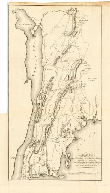
A Revolutionary War map of the area east of... (full text available to subscribers)
Item Detail
 
  MapMaker:  

John Marshall


  Subject:  New York  
  Period/Size:  1809 / 16.0" x 8.8"  (40.7 x 22.4 cm)  
  Color:  Black & White  
  Condition:  (A) Crisp impression. Folding as issued with binder's trim nearly to neatline at left and damp stain in top margin. (condition help)  
  Source:  Het Leven van George Washington…  
  References:   
 
 
Sales Information
 
  Price: 

Please register your email to view records, or sign in with email address to see records


  Offered by:  Old World Auctions  
  Catalog:  Auction No. 108 - Antique Maps, Charts, Atlases & Globes (362)  
  Lot/Item #:  211  
 
  Date:  09/2004  


Antique Maps - Valuation and Pricing, Descriptions, Resources


Home | Information | Search | Register | Contact Us | Site Map

Americana Exchange, Inc. © 1999 - 2024 Americana Exchange, Inc.. All rights reserved. OldMaps.com, the OldMaps.com logo and
AMPR are service marks or registered service marks of Americana Exchange, Inc..