Title:
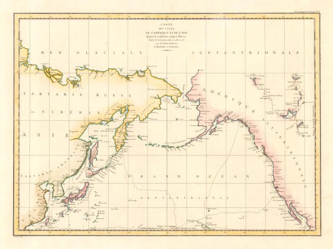
“Carte des Cotes de l' Amerique et de l' Asie depuis la Californie jusqu a Macao”
Map Maker:
Jean Francois Galaup de La Perouse
Large-scale map showing the extent of La Perouse's... (full text available to subscribers)
| Item Detail |
| |
| |
MapMaker: |
Jean Francois Galaup de La Perouse
|
|
| |
| |
Subject: |
North Pacific Ocean |
|
| |
Period/Size: |
1797 / 19.8" x 27.0" (50.3 x 68.6 cm)
|
|
| |
Color: |
Colored
|
|
| |
Condition: |
(A) (condition help) |
|
| |
Source: |
Atlas du Voyage de la Perouse |
|
| |
References: |
|
|
| |
|
|
| Sales Information |
| |
| |
Price: |
|
|
| |
| |
Offered by: |
Old World Auctions |
|
| |
Catalog: |
Auction No. 108 - Antique Maps, Charts, Atlases & Globes (362) |
|
| |
Lot/Item #: |
623 |
|
| |
| |
Date: |
09/2004
|
|
| |
| |
|
Antique Maps - Valuation and Pricing, Descriptions, Resources |
|
Home |
Information |
Search |
Register |
Contact Us |
Site Map
Americana Exchange, Inc. © 1999 - 2024 Americana Exchange, Inc.. All rights reserved.
OldMaps.com, the OldMaps.com logo and
AMPR are service marks or registered service marks of Americana Exchange, Inc..
|