Title:
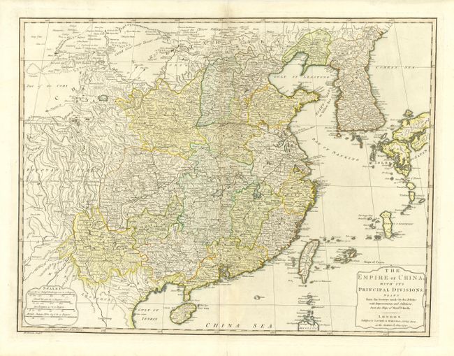
“The Empire of China, with its Principal Divisions; Drawn from the Surveys made by the Jesuits:…”
Map Maker:
Laurie & Whittle
Fine detailed map covering all of China, Taiwan, K... (full text available to subscribers)
| Item Detail |
| |
| |
MapMaker: |
Laurie & Whittle
|
|
| |
| |
Subject: |
China and Korea |
|
| |
Period/Size: |
1794 / 18.7" x 24.5" (47.5 x 62.3 cm)
|
|
| |
Color: |
Colored
|
|
| |
Condition: |
(B) Faint centerfold toning, else very good. (condition help) |
|
| |
Source: |
|
|
| |
References: |
|
|
| |
|
|
| Sales Information |
| |
| |
Price: |
|
|
| |
| |
Offered by: |
Old World Auctions |
|
| |
Catalog: |
Auction No. 108 - Antique Maps, Charts, Atlases & Globes (362) |
|
| |
Lot/Item #: |
580 |
|
| |
| |
Date: |
09/2004
|
|
| |
| |
|
Antique Maps - Valuation and Pricing, Descriptions, Resources |
|
Home |
Information |
Search |
Register |
Contact Us |
Site Map
Americana Exchange, Inc. © 1999 - 2024 Americana Exchange, Inc.. All rights reserved.
OldMaps.com, the OldMaps.com logo and
AMPR are service marks or registered service marks of Americana Exchange, Inc..
|