Title:
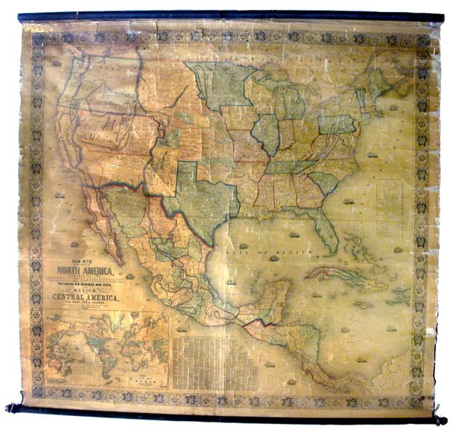
“New Map of that portion of North America, exhibiting the United States and Territories, the Canadas, New Brunswick, Nova Scotia and Mexico, also Central America and the West India Islands”
Map Maker:
Jacob Monk
An early and majestic wall map that was published ... (full text available to subscribers)
| Item Detail |
| |
| |
MapMaker: |
Jacob Monk
|
|
| |
| |
Subject: |
North America |
|
| |
Period/Size: |
1852 / 55.4" x 59.5" (140.8 x 151.2 cm)
|
|
| |
Color: |
Colored
|
|
| |
Condition: |
(B) Overall light toning of varnish with some staining along top edge. Roughness along sides, lacking ribbon binding, with one small loss to border. Numerous worm holes along left edge in Pacific and part of the world map inset. (condition help) |
|
| |
Source: |
|
|
| |
References: |
Wheat (TMW) #794; Wheat (GOLD) 243; Rumsey 602. |
|
| |
|
|
| Sales Information |
| |
| |
Price: |
|
|
| |
| |
Offered by: |
Old World Auctions |
|
| |
Catalog: |
Auction No. 108 - Antique Maps, Charts, Atlases & Globes (362) |
|
| |
Lot/Item #: |
107 |
|
| |
| |
Date: |
09/2004
|
|
| |
| |
|
Antique Maps - Valuation and Pricing, Descriptions, Resources |
|
Home |
Information |
Search |
Register |
Contact Us |
Site Map
Americana Exchange, Inc. © 1999 - 2024 Americana Exchange, Inc.. All rights reserved.
OldMaps.com, the OldMaps.com logo and
AMPR are service marks or registered service marks of Americana Exchange, Inc..
|