| Item Detail |
| |
| |
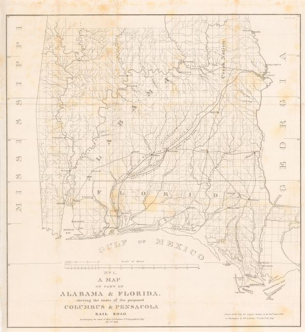
MapMaker: |
U.S. Corps of Engineers
|
|
| |
| |
Subject: |
Southeastern United States |
|
| |
Period/Size: |
1836 / 22.0" x 20.7" (55.9 x 52.6 cm)
|
|
| |
Color: |
Black & White
|
|
| |
Condition: |
(B) Issued folding, now backed with archival tissue. Occasional light scattered foxing. (condition help) |
|
| |
Source: |
HR. Doc. 176, 24th Cong., 1st Sess. |
|
| |
References: |
Clausen & Friis #125; Modelski (Railroads) #388. |
|
| |
|
|
| Sales Information |
| |
| |
Price: |
|
|
| |
| |
Offered by: |
Old World Auctions |
|
| |
Catalog: |
Auction No. 109 - Antique Maps, Charts, Atlases & Globes (385) |
|
| |
Lot/Item #: |
159 |
|
| |
| |
Date: |
12/2004
|
|
| |
| |
|