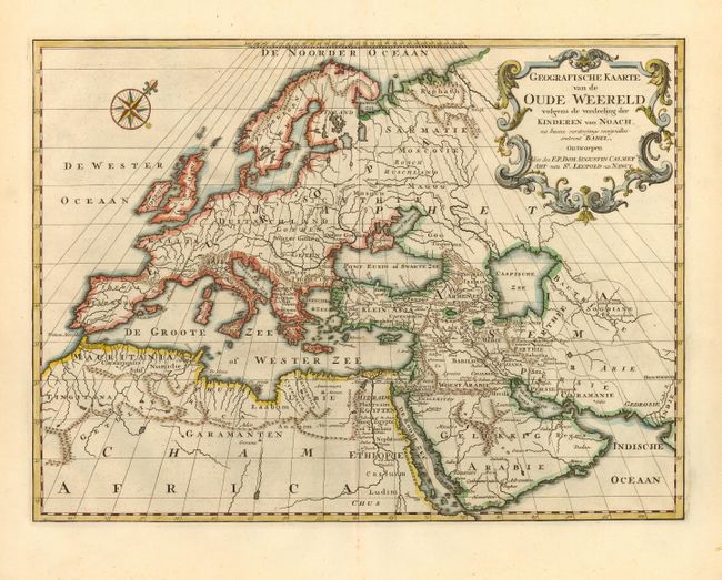
Title:
“Geografische Kaarte van de Oude Weereld volgens de verdeeling der Kinderen van Noach…”
Map Maker:
Rudolf & Gerard Wetstein
A finely colored and classic map of the ancient wo... (full text available to subscribers)
| Item Detail |
| |
| |
MapMaker: |
Rudolf & Gerard Wetstein
|
|
| |
| |
Subject: |
Ancient World |
|
| |
Period/Size: |
1728 / 13.0" x 17.4" (33.1 x 44.2 cm)
|
|
| |
Color: |
Black & White
|
|
| |
Condition: |
(A) Dark impression and fine coloring. On fine hand laid paper with large watermark and wide margins. One tiny spot in Mediterranean, else fine. (condition help) |
|
| |
Source: |
|
|
| |
References: |
|
|
| |
|
|
| Sales Information |
| |
| |
Price: |
|
|
| |
| |
Offered by: |
Old World Auctions |
|
| |
Catalog: |
Auction No. 109 - Antique Maps, Charts, Atlases & Globes (385) |
|
| |
Lot/Item #: |
041 |
|
| |
| |
Date: |
12/2004
|
|
| |
| |
|
Antique Maps - Valuation and Pricing, Descriptions, Resources |
|
Home |
Information |
Search |
Register |
Contact Us |
Site Map
Americana Exchange, Inc. © 1999 - 2024 Americana Exchange, Inc.. All rights reserved.
OldMaps.com, the OldMaps.com logo and
AMPR are service marks or registered service marks of Americana Exchange, Inc..
|