Title:
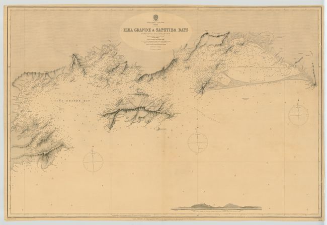
“South America - East Coast Brazil Ilha Grande & Sapetiba Bays”
Map Maker:
British Admiralty
Handsome, large-scale sea chart of the region just... (full text available to subscribers)
| Item Detail |
| |
| |
MapMaker: |
British Admiralty
|
|
| |
| |
Subject: |
Brazil |
|
| |
Period/Size: |
1884 / 25.7" x 38.2" (65.3 x 97.1 cm)
|
|
| |
Color: |
Black & White
|
|
| |
Condition: |
(A) Narrow margins, as issued. (condition help) |
|
| |
Source: |
|
|
| |
References: |
|
|
| |
|
|
| Sales Information |
| |
| |
Price: |
|
|
| |
| |
Offered by: |
Old World Auctions |
|
| |
Catalog: |
Auction No. 109 - Antique Maps, Charts, Atlases & Globes (385) |
|
| |
Lot/Item #: |
326 |
|
| |
| |
Date: |
12/2004
|
|
| |
| |
|
Antique Maps - Valuation and Pricing, Descriptions, Resources |
|
Home |
Information |
Search |
Register |
Contact Us |
Site Map
Americana Exchange, Inc. © 1999 - 2024 Americana Exchange, Inc.. All rights reserved.
OldMaps.com, the OldMaps.com logo and
AMPR are service marks or registered service marks of Americana Exchange, Inc..
|