Title:
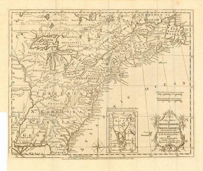
“A New Map of the British Dominions in North America with the Limits of the Governments annexed thereto by the late Treaty of Peace and settled by Proclamation, October 7th, 1763”
Map Maker:
Thomas Kitchin
A very historical map illustrating the British col... (full text available to subscribers)
| Item Detail |
| |
| |
MapMaker: |
Thomas Kitchin
|
|
| |
| |
Subject: |
Colonial North America |
|
| |
Period/Size: |
1763 / 9.5" x 12.0" (24.2 x 30.5 cm)
|
|
| |
Color: |
Black & White
|
|
| |
Condition: |
(A) Nice impression on thick hand laid paper with full margins. Folding, as issued. (condition help) |
|
| |
Source: |
History of Warģ |
|
| |
References: |
McCorkle 753.5; Sellers & Van Ee 103; Jolly ANNREG-3. |
|
| |
|
|
| Sales Information |
| |
| |
Price: |
|
|
| |
| |
Offered by: |
Old World Auctions |
|
| |
Catalog: |
Auction No. 109 - Antique Maps, Charts, Atlases & Globes (385) |
|
| |
Lot/Item #: |
111 |
|
| |
| |
Date: |
12/2004
|
|
| |
| |
|
Antique Maps - Valuation and Pricing, Descriptions, Resources |
|
Home |
Information |
Search |
Register |
Contact Us |
Site Map
Americana Exchange, Inc. © 1999 - 2024 Americana Exchange, Inc.. All rights reserved.
OldMaps.com, the OldMaps.com logo and
AMPR are service marks or registered service marks of Americana Exchange, Inc..
|