Title:
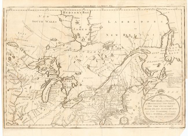
“New Map of the States of Pensylvania New Jersey New York Connecticut Rhode Island Massachusets and New Hampshire Including Nova Scotia and Canada”
Map Maker:
William Gordon
An attractive and delicately engraved map showing ... (full text available to subscribers)
| Item Detail |
| |
| |
MapMaker: |
William Gordon
|
|
| |
| |
Subject: |
Canada & United States |
|
| |
Period/Size: |
1789 / 10.6" x 16.0" (27.0 x 40.7 cm)
|
|
| |
Color: |
Black & White
|
|
| |
Condition: |
(B) On fine hand laid paper with a large watermark. Short binding trim tear into blank area of map, professionally closed on verso. (condition help) |
|
| |
Source: |
History of the Rise of the United States |
|
| |
References: |
McCorkle 789.9; Sellers and Van Ee 197; Kershaw II: 258. |
|
| |
|
|
| Sales Information |
| |
| |
Price: |
|
|
| |
| |
Offered by: |
Old World Auctions |
|
| |
Catalog: |
Auction No. 109 - Antique Maps, Charts, Atlases & Globes (385) |
|
| |
Lot/Item #: |
143 |
|
| |
| |
Date: |
12/2004
|
|
| |
| |
|
Antique Maps - Valuation and Pricing, Descriptions, Resources |
|
Home |
Information |
Search |
Register |
Contact Us |
Site Map
Americana Exchange, Inc. © 1999 - 2024 Americana Exchange, Inc.. All rights reserved.
OldMaps.com, the OldMaps.com logo and
AMPR are service marks or registered service marks of Americana Exchange, Inc..
|